Point Cloud to BIM Services
Your building as a working model with geometry and data, built from what's actually built.

Years of Experience
Successful Projects
Countries Served
Happy Clients
Parametric BIM Models Built From Your Scan Data.
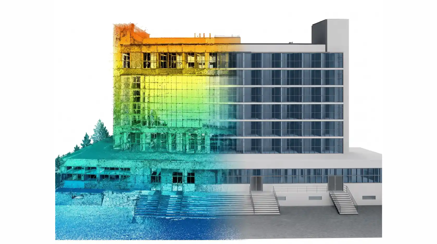
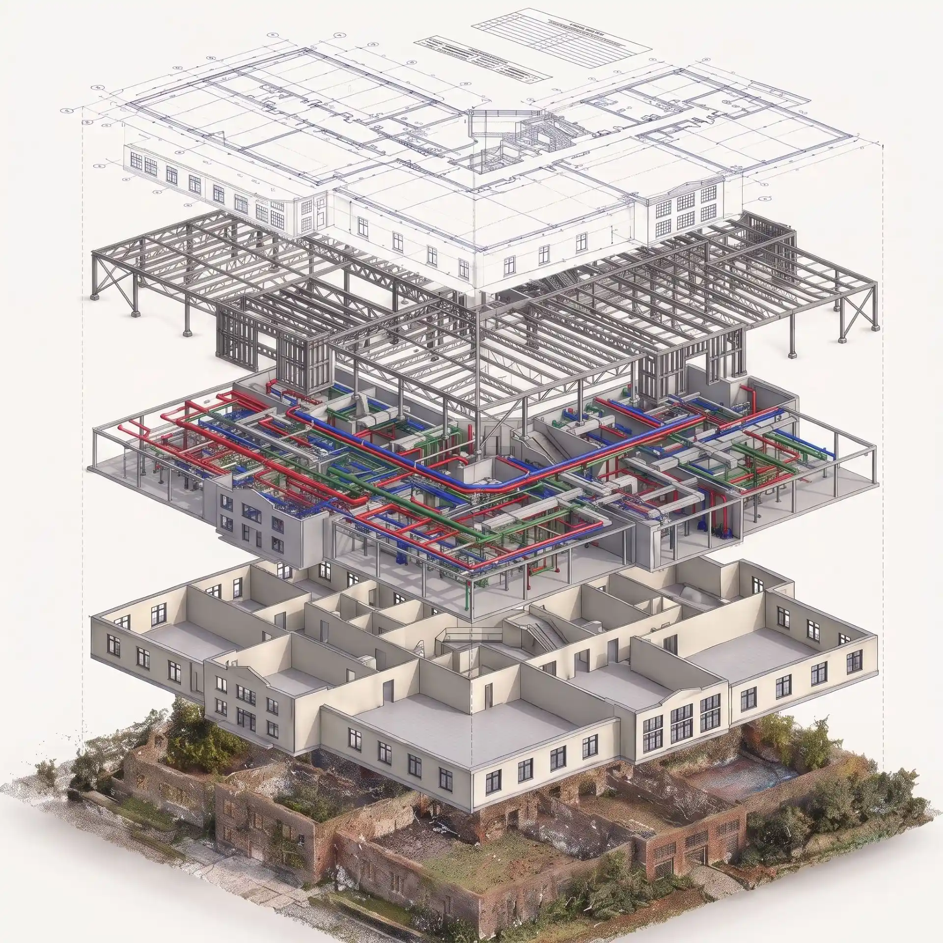
A point cloud is data. A BIM model is understandable. Scan to BIM takes registered laser scan and point cloud data and converts it into accurate, parametric BIM models. These are parametric 3D representations of your building's existing condition, structured with geometry, classification and embedded asset data that your whole project team can work from.
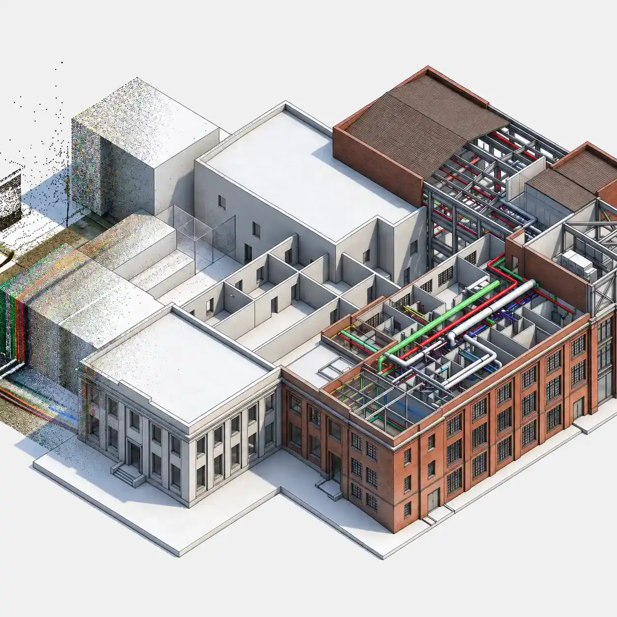
Where a scan gives you a dense cloud of measured points, a point cloud-derived BIM model gives you something your architects, engineers, contractors and facilities managers can actually use. Walls, floors, columns, pipes, ducts and equipment are modelled as editable, schedulable BIM elements at the Level of Detail your project specifies.
Six Project Triggers
A Point Cloud to BIM model becomes essential at each of these project stages.

Refurbishment & Extension
Design teams need an accurate existing-conditions model before scoping or tendering a refurbishment or extension project.
FM & Asset Management
Facilities teams building an as-installed BIM model for planned maintenance, lifecycle management and FM software integration.
Heritage Documentation
Conservation teams requiring a fully measured, parametric BIM record of a listed or heritage building's current condition.
Retrofit & Decarbonisation
Energy and MEP engineers needing accurate existing fabric and services models as the base for retrofit design.
Construction Co-ordination
Main contractors requiring a co-ordinated as-installed model across disciplines for clash detection and programme management.
Planning & Conservation
Projects requiring a verified, information-rich model to support planning applications or heritage consent submissions.
Scan-Derived BIM vs. Design Intent BIM
What changes when a BIM model is built from verified scan data rather than design drawings?
Built from design drawings. Reflects intent, not what was constructed.
Built from registered scan data. Reflects the building as it physically stands.
Accumulated site variations, changes and substitutions are absent from the model.
Every change, substitution and site variation is reflected in the model geometry.
Unreliable for refurbishment, retrofit and FM without extensive verification.
Reliable base for refurbishment, retrofit, co-ordination and FM immediately on issue.
Dimensions represent design specification, not verified built dimensions.
Every dimension is verified against scan geometry; no estimates or approximations.
Risk of clash failures when used as a base for a new design in existing buildings.
Verified spatial co-ordinates reduce clash risk in retrofit and extension design.


What You Receive
Sectors We Model
| Deliverable | Scope & Detail |
|---|---|
| Architectural BIM Model | Existing fabric modelled as parametric elements (walls, floors, roofs, doors and windows) at agreed LOD. |
| Structural Steel BIM Model | Steel framing, connections and bracing as constructed, including member profiles, grid lines and levels. |
| MEP BIM Model | Existing mechanical, electrical and plumbing services as installed (pipe runs, duct routes, equipment and electrical containment). |
| Co-ordinated Combined Model | All discipline models are federated into a single Navisworks or Revit file, with spatial conflicts identified and flagged before issues arise. |
| Feature | What It Means |
|---|---|
| Clash Detection Report | Documented clash report from the co-ordinated model: hard clashes, soft clashes and clearance issues with priority and location. |
| As-Built Views & Sheets | Floor plans, sections, elevations and schedules extracted from the model and issued as DWG and PDF at agreed scales. |
| COBie Data Export | Asset data exported in COBie format. Spaces, components, types and systems are mapped and tagged for FM and CAFM integration. |
| Issue Formats | Native Revit .rvt, IFC 2x3 or IFC 4, Navisworks .nwc (version-matched, CDE-named, with model content schedule.) |
Features Included
Level of Detail | Up to LOD 500
We confirm the required LOD at the scope stage. Most existing-building BIM projects run at LOD 300 or 400.
LOD 200
200- Approximate element geometry
- Correct overall dimensions and positions
- Generic element types. No specific product data
 For: concept design, space planning, early scoping
LOD 300
300- Accurate element geometry and quantity
- Specific element types and materials
- Sufficient for design co-ordination and planning
For: refurbishment design, planning, and co-ordination
LOD 400
400- Fabrication-level accuracy and detailing
- Full classification and Uniclass coding
- COBie data and FM-ready asset parameters
For: construction, FM, asset management, retrofit
How It Works
Every project follows a structured five-stage workflow from scope agreement through to reviewed issue.
Who Avails Our Point Cloud to BIM Services
Six client types who regularly commission Point Cloud to BIM from Scan to BIM.

Architects & Designers
Accurate existing-conditions BIM models as the verified base for extension, refurbishment and retrofit design.
Facilities Managers
FM-ready BIM models tagged with COBie data. Spaces, assets and systems mapped for CAFM integration.
Main Contractors
Co-ordinated as-installed models for handover packages, snagging programmes and FM-ready BIM deliverables.
Heritage & Conservation Teams
Parametric BIM models of listed and historic buildings for conservation management and heritage consent submissions.
MEP Engineers
Existing service models for retrofit, re-engineering and co-ordination with new MEP design in constrained spaces.
BIM Managers & Co-ordinators
Extend an existing project BIM environment with scan-derived as-built models produced to your CDE standards.
Related Services
Point Cloud to BIM is part of Scan to BIM’s full list of services.
Frequently Asked Questions
None. Both names describe the same service: converting a registered point cloud into a parametric Revit model. We do not carry out the scanning.
Point Cloud to BIM covers one discipline or all three. Architectural, Structural and MEP Scan to BIM are the same service scoped to a single discipline, for clients who need only one model.
We work to LOD as agreed at the scope stage. Most existing building projects are specified at LOD 300 or 400. LOD 400 is specified when the model will be used for FM, asset management, fabrication or detailed retrofit design.
Yes. Where COBie is required, we structure the model with the appropriate space, component, type and system data to support COBie export. COBie deliverables are confirmed and mapped at the scope stage.
Start Your Scan to BIM Project
Send us your scan data details, point cloud format and project requirements. We will review your brief, confirm scope and have the right team allocated within 48 hours.
NDA Protected
All scan data, project files and client information handled under strict NDA.
100% Confidential
Your data stays yours. We guarantee full confidentiality throughout the project.
24-Hour Response
Send us your brief today. You’ll hear back from our team within one business day.