Scan to Mesh Creation Services
Accurate 3D mesh models from point cloud and laser scan data for complex geometry; the exact surface of your building, meshed as it is.

Years of Experience
Successful Projects
Countries Served
Happy Clients
Accurate 3D Surface Models From Your Scan Data
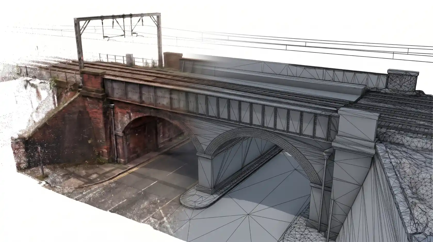
Not every project asset needs to be a parametric BIM element. Ornate facades, heritage stonework, congested service runs and natural terrain all carry a level of irregularity that a BIM family was never built to represent. Scan to BIM generates accurate, scan-derived 3D mesh models for this kind of geometry, representing the surface exactly as it was scanned, with no simplification or approximation.
Where a parametric model represents a typical version of an object, a mesh represents the actual one. For visualisation, clash detection, reference and heritage documentation, that difference matters.
Six Project Triggers
A mesh becomes the right choice at each of these project stages.

Complex/Organic Geometry
Ornate facades, sculptural elements or curved forms that don't reduce cleanly into parametric BIM elements.
Heritage Documentation
Full-fidelity surface meshes of stonework, mouldings and decorative features for conservation records.
Visualisation & VR/AR
Photorealistic walkthroughs, digital twins and stakeholder presentations built on real captured geometry.
MEP Clash Reference
A dense, accurate backdrop mesh of congested service zones for clash detection in Navisworks.
Terrain & Topography
Ground surface and site topology converted to a mesh for civil co-ordination and earthworks planning.
Marketing & Digital Twins
Textured, photorealistic mesh models for property marketing, virtual tours and digital twin platforms.
Mesh vs. Parametric BIM | When Geometry Doesn't Fit a Family
Here is what changes when complex geometry is delivered as a mesh, rather than forced into a BIM element.
Complex or curved geometry forced into standard parametric shapes.
Exact surface geometry generated directly from the scan, regardless of form.
Time-intensive to parametrise ornate or one-off geometry accurately.
Generated directly from point cloud data; no manual parametrisation required.
Risk of losing surface detail when simplified into BIM primitives.
Every undulation, profile and surface detail preserved exactly as scanned.
Editable and schedulable, but only as accurate as the model build.
Non-editable, but dimensionally true to the physical object as captured.
Best suited to elements with regular, clearly definable geometry.
Best suited to organic, ornate, or geometrically complex elements.


What You Receive
Our deliverables are structured around how the mesh will actually be used. Scope and density tier are confirmed at the start and every item below is QA-reviewed against the source scan data before issue.
| Mesh Type | Scope & Detail |
|---|---|
| Architectural Facade Mesh | Full building envelopes, ornate facades and surfaces meshed as continuous, accurate geometry. |
| Heritage & Ornamental Mesh | Stonework, mouldings, carvings and decorative features meshed at full surface fidelity for conservation records. |
| MEP Congestion Mesh | Dense, accurate mesh of congested service zones used as a reference backdrop for clash detection and co-ordination. |
| Structural Complex-Form Mesh | Curved or irregular structural geometry (vaults, shells, custom trusses) delivered as mesh rather than a parametric family. |
| Terrain & Topography Mesh | Ground surface and site topology meshed from scan data, for civil co-ordination, earthworks and drainage design. |
| Textured / Photorealistic Mesh | Photorealistic texture mapping applied to mesh geometry for visualisation, marketing and digital twin platforms. |
| Optimised Visualisation Mesh | Decimated, lightweight mesh versions suitable for web viewers, VR headsets and AR applications. |
| Issue Formats | OBJ, FBX and STL for general use. NWC for Navisworks co-ordination; linked mesh insertion into Revit where required. |
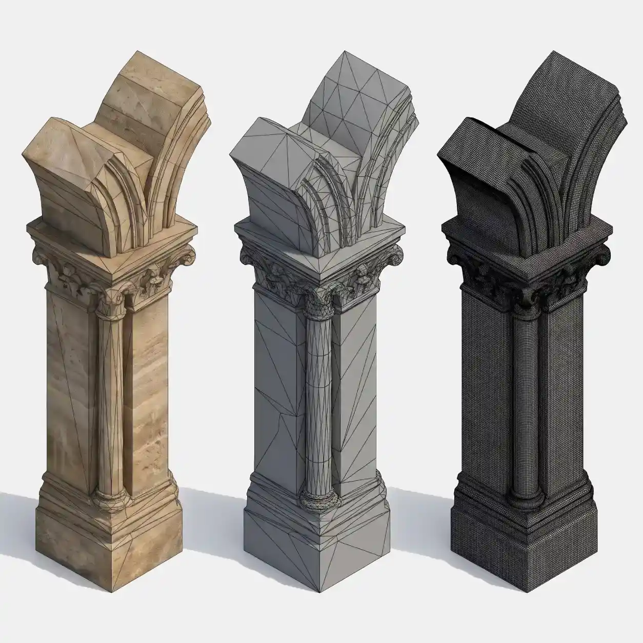
Mesh Density | Visualisation to Engineering Grade
We confirm the required tier at the scope stage. Heritage and fabrication work specifies Tier 3.
Tier 1: Visualisation
T1- Decimated, lightweight mesh
- Optimised for fast loading and playback
- Texture mapping applied where needed
 For: walkthroughs, web, VR/AR
Tier 2: Co-ordination
T2- Medium-density surface mesh
- Accurate enough for clash reference
- Balanced file size for Navisworks use
For: clash detection, model backdrop
Tier 3: Engineering
T3- Full-resolution, high-density mesh
- Sub-millimetre surface fidelity
- Suitable for dimensional verification
For: heritage record, fabrication
How It Works
From scope to integration, our projects follow the same 5-step structured workflow.
Who Avails Our Scan to Mesh Service
Six client types who regularly commission mesh creation from Scan to BIM.

Heritage & Conservation Teams
Full-fidelity surface meshes of ornate stonework and architectural features for conservation records.
Civil & Infrastructure Engineers
Terrain and topography mesh for earthworks planning, drainage design and civil co-ordination.
BIM Co-ordinators & MEP Contractors
Dense, accurate mesh of congested service zones used as a clash detection reference backdrop.
Facilities Managers
Visual digital-twin reference models for estates teams managing complex or heritage assets.
Visualisation & Marketing Teams
Photorealistic mesh models for walkthroughs, digital twins and property marketing content.
Survey Companies
To extend their deliverable set with production-quality mesh output from the scan data.
Geometry & Surface Types We Cover
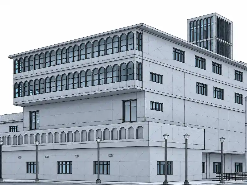
Architectural Facades
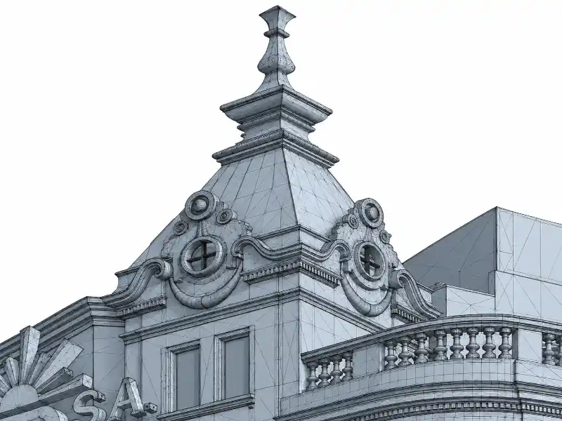
Heritage Stonework
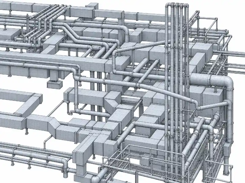
MEP Congested Zones
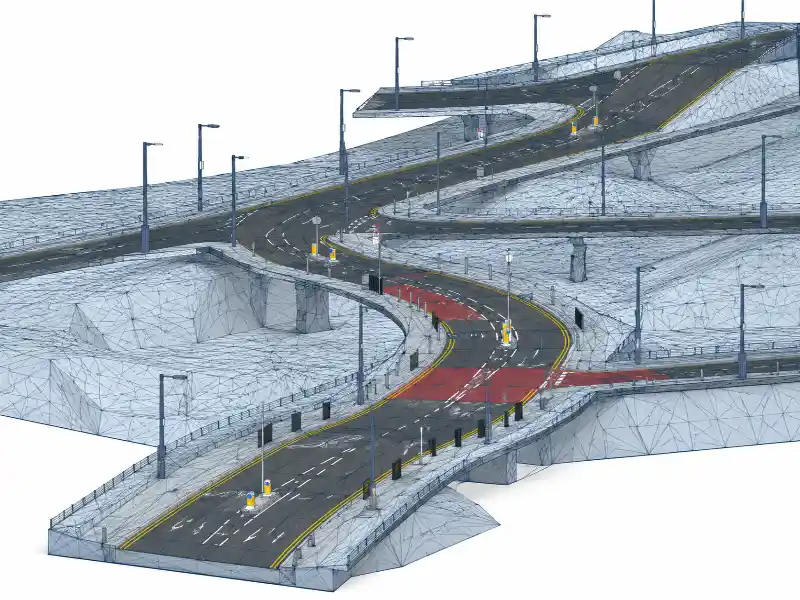
Terrain & Topography
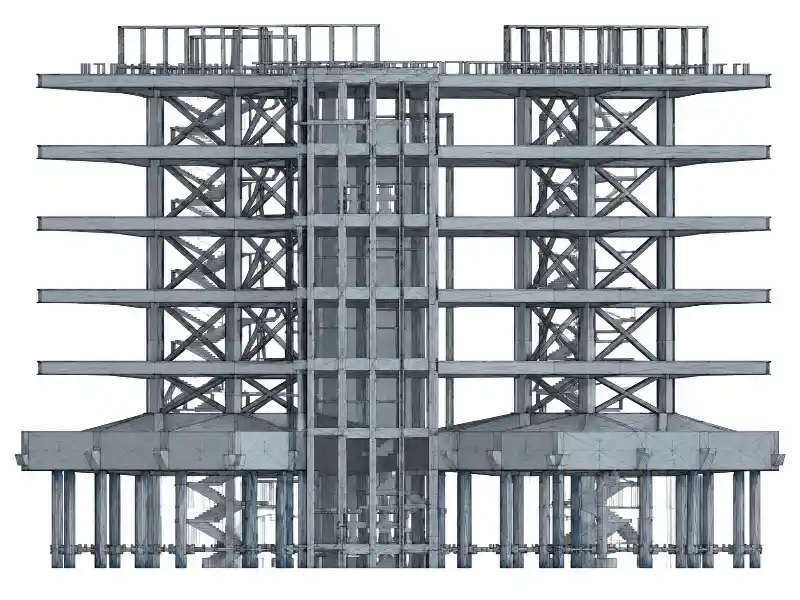
Complex Structural Forms
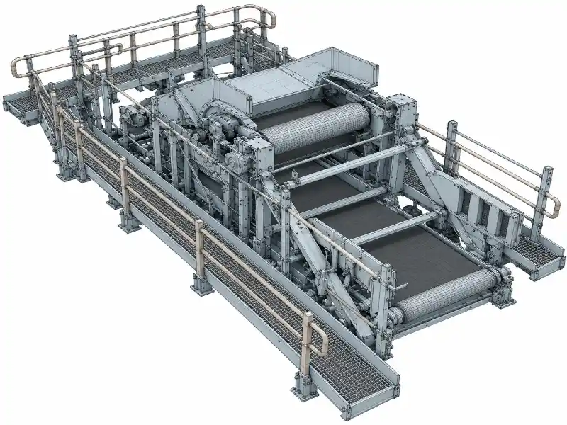
Industrial Plant
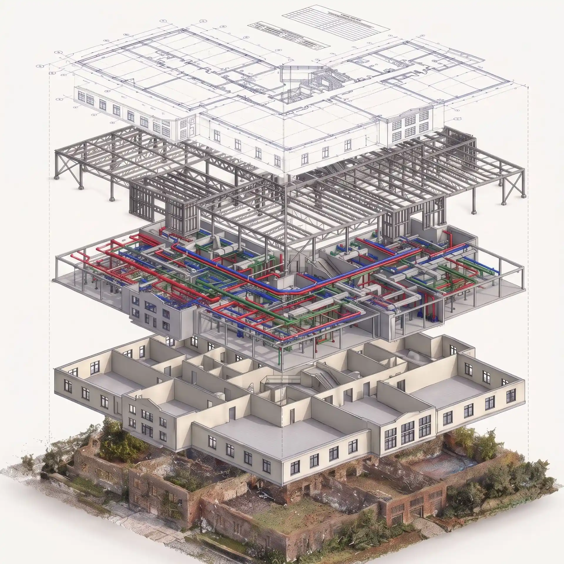
Related Services
Scan to Mesh Creation is part of Scan to BIM’s full list of services. Explore all our services here:
Frequently Asked Questions
A mesh is a triangulated surface generated directly from point cloud data, representing exactly what was scanned, with no parametric elements or embedded data. A BIM model is built from parametric, schedulable elements. Mesh is chosen when the geometry itself is what matters most.
Mesh is the right choice for organic, ornate or complex geometry that doesn't reduce cleanly into standard BIM elements (eg: heritage stonework, sculptural facades, congested MEP zones, or terrain). For elements that need to be scheduled, tagged or maintained as data, a parametric family or BIM element is more appropriate.
Yes. Mesh is frequently used as a reference backdrop within a co-ordinated BIM environment.
We work to three density tiers, confirmed at the scope stage: Visualisation (lightweight, for walkthroughs and VR/AR), Co-ordination (medium density, for clash reference) and Engineering (full-resolution, for fabrication and heritage records).
Yes. Where required, we apply photorealistic texture mapping to the mesh surface. This is commonly used for visualisation, marketing content and digital twin platforms.
Start Your Scan to BIM Project
Send us your scan data details, point cloud format and project requirements. We will review your brief, confirm scope and have the right team allocated within 48 hours.
NDA Protected
All scan data, project files and client information handled under strict NDA.
100% Confidential
Your data stays yours. We guarantee full confidentiality throughout the project.
24-Hour Response
Send us your brief today. You’ll hear back from our team within one business day.